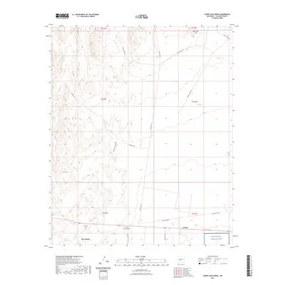
2023 Map of Canon Agua Buena
USGS Topo · Published 2023About this map
Carthage and Old Carthage anchor the southern reaches of this landscape, marking a historic mining district south of the Blackington Hills. The presence of the Carthage Cem reflects the long-standing community tied to these coal-rich lands, while the vast southern boundary is defined by the White Sands Missile Range. This map shows a desert environment dominated by drainages like Cañon Agua Buena and the San Pedro Arroyo, which cut through the high desert floor toward the Cerro del Viboro. Water management in this arid terrain is evidenced by small reservoirs such as CC Tank and Triple A Tank. A network of specialized routes, including Quebrada Rd and several White Sands Missile Range roads, provides the primary access through this sparsely populated section of Socorro County.
Find a feature on this map
24 named features on this map. Tap any name to fly to it.
Don’t see what you’re looking for? This feature index may not catch every label — zoom into the map to look around manually.
Map Details
Editions of this 2023 Canon Agua Buena Map
This is the sole edition of this map. No revisions or reprints were ever made.
Other maps of this area

1906 · Socorro
USGS Topo · 1:62,500

1916 · La Joya
USGS Topo · 1:125,000

1948 · Carthage
USGS Topo · 1:62,500

1948 · San Antonio
USGS Topo · 1:62,500

1954 · Tularosa
USGS Topo · 1:250,000

1954 · Socorro
USGS Topo · 1:250,000

1958 · Socorro
USGS Topo · 1:250,000

1958 · Tularosa
USGS Topo · 1:250,000

1959 · Loma De Las Canas
USGS Topo · 1:24,000

1959 · Socorro
USGS Topo · 1:62,500