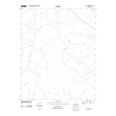
2010 Map of Canon Ancho
USGS Topo · Published 2010About this map
Cañon Ancho cuts through this high desert region of New Mexico, forming a central drainage system that dictates the placement of isolated outposts like Paltenghe Ranch. The landscape is defined by a series of deep canyons and seasonal watercourses, including the Mora River and Tata Vique, which snake through the arid terrain. The presence of the Eureka Ranch Airport provides a rare point of modern connectivity in an area otherwise dominated by the natural geometry of the land, such as School Section Canyon and Mexican Canyon. Local ranching footprints are visible through specific landmarks like Romero and Vega Sixtysix, illustrating how water and topography have historically shaped settlement patterns and land use in this part of San Miguel County.
Find a feature on this map
21 named features on this map. Tap any name to fly to it.
Don’t see what you’re looking for? This feature index may not catch every label — zoom into the map to look around manually.
Map Details
Editions of this 2010 Canon Ancho Map
This is the sole edition of this map. No revisions or reprints were ever made.
Other maps of this area

1892 · Watrous
USGS Topo · 1:125,000

1894 · Watrous
USGS Topo · 1:125,000

1954 · Santa Fe
USGS Topo · 1:250,000

1958 · Santa Fe
USGS Topo · 1:250,000

1964 · Frutosa Lake
USGS Topo · 1:24,000

1964 · Mogote Hills
USGS Topo · 1:24,000

1964 · Alamosa Creek
USGS Topo · 1:24,000

1964 · Canon Ancho
USGS Topo · 1:24,000

1971 · Alamito
USGS Topo · 1:24,000

1971 · Canon Las Cuevas
USGS Topo · 1:24,000