
1964 Map of Frutosa Lake
USGS Topo · Published 1966About this map
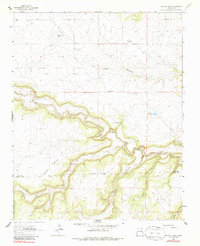
The Mora River winds through a landscape defined by deep canyons and high plateaus in this mid-1960s survey of northeastern New Mexico. This region at the border of Mora and San Miguel Counties illustrates a dispersed ranching economy, where survival depends on water sources like Frutosa Lake, Morrison Lake, and the naturally occurring Cabra Spring. The map documents the specific infrastructure of the era's land management, marking family-named ranching outposts such as Wiggins Ranch and Berlier Ranch alongside a series of vital water-pumping landmarks including Morrison Windmill and Taylor Windmill. Landforms such as Mejan Mesa and the wooded heights of Altos Pinos separate the various drainages of Pedroso Creek and Carrizo Creek. Local history is anchored by the Escondido Cem, located near the northern reaches of the Cañon Escondido.
Find a feature on this map
27 named features on this map. Tap any name to fly to it.
Don’t see what you’re looking for? This feature index may not catch every label — zoom into the map to look around manually.
Map Details
Editions of this 1964 Frutosa Lake Map
2 editions found
Other maps of this area

1892 · Watrous
USGS Topo · 1:125,000

1894 · Watrous
USGS Topo · 1:125,000

1954 · Santa Fe
USGS Topo · 1:250,000

1958 · Santa Fe
USGS Topo · 1:250,000

1964 · Mogote Hills
USGS Topo · 1:24,000

1964 · Alamosa Creek
USGS Topo · 1:24,000

1964 · Canon Ancho
USGS Topo · 1:24,000
1966 · Cherry Valley Lake
USGS Topo · 1:24,000
1966 · Optimo
USGS Topo · 1:24,000
1971 · Canon Pedroso
USGS Topo · 1:24,000