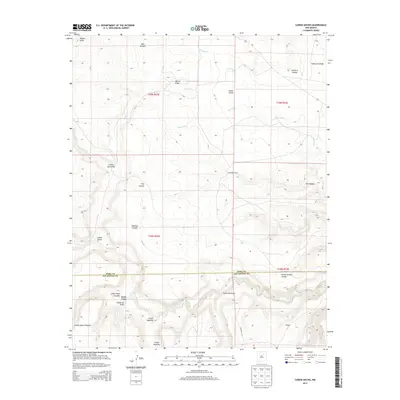
2013 Map of Canon Ancho
USGS Topo · Published 2013About this map
The Mora River winds through this section of the New Mexico high plains, where the landscape is defined by an intricate network of drainages and named canyons. Human presence is light but distinct, marked by sites such as the Paltenghe Ranch and the small settlement of Vega Sixtysix. The topography is a maze of geological features, from the broad Cañon Ancho to more specialized areas like School Section Canyon and Mexican Canyon. Local transit is represented by CO Road C 53-A, which provides access through the southeastern portion of the quadrangle. The naming conventions throughout the area, including Tata Vique, Sixtysix Cr, and Cañon Encinoso, reflect the cultural and ranching history of the border region between Mora and San Miguel counties.
Find a feature on this map
25 named features on this map. Tap any name to fly to it.
Don’t see what you’re looking for? This feature index may not catch every label — zoom into the map to look around manually.
Map Details
Editions of this 2013 Canon Ancho Map
This is the sole edition of this map. No revisions or reprints were ever made.
Other maps of this area

1892 · Watrous
USGS Topo · 1:125,000

1894 · Watrous
USGS Topo · 1:125,000

1954 · Santa Fe
USGS Topo · 1:250,000

1958 · Santa Fe
USGS Topo · 1:250,000

1964 · Frutosa Lake
USGS Topo · 1:24,000

1964 · Mogote Hills
USGS Topo · 1:24,000

1964 · Alamosa Creek
USGS Topo · 1:24,000

1964 · Canon Ancho
USGS Topo · 1:24,000

1971 · Alamito
USGS Topo · 1:24,000

1971 · Canon Las Cuevas
USGS Topo · 1:24,000