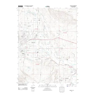
2013 Map of Canon City
USGS Topo · Published 2013About this map
The Arkansas River corridor defines the geography of this Fremont County region, supporting an extensive network of irrigation canals and ditches that shaped local development. Features such as the De Weese Dye Ditch, Fruitland Ditch, and Grandview Ditch underscore the importance of water management in this arid landscape. Surrounding the urban center of Cañon City, the map details a dense concentration of residential and agricultural communities, including Lincoln Park, Orchard Park, and Prospect Heights.
Find a feature on this map
137 named features on this map. Tap any name to fly to it.
Don’t see what you’re looking for? This feature index may not catch every label — zoom into the map to look around manually.
Map Details
Editions of this 2013 Canon City Map
This is the sole edition of this map. No revisions or reprints were ever made.
Other maps of this area

1889 · Canon City
USGS Topo · 1:125,000

1892 · Canon City
USGS Topo · 1:125,000

1894 · Pikes Peak
USGS Topo · 1:125,000

1901 · Pikes Peak
USGS Topo · 1:125,000

1942 · Cover Mtn.
USGS Topo · 1:62,500

1948 · Cover Mtn.
USGS Topo · 1:62,500

1954 · Phantom Canyon
USGS Topo · 1:24,000

1954 · Cooper Mountain
USGS Topo · 1:24,000

1954 · Pueblo
USGS Topo · 1:250,000

1957 · Pueblo
USGS Topo · 1:250,000