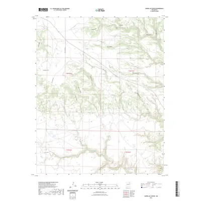
2023 Map of Canon Las Cuevas
USGS Topo · Published 2023About this map
Carrizo Creek and Beaver Creek wind through a complex system of drainage networks along the border of Mora and Harding counties. This arid landscape is defined by its dramatic verticality, characterized by the Cuernudo Hills and a dense concentration of named canyons. Transport across the terrain is limited, primarily utilizing Mills Canyon Rd, reflecting the sparse settlement patterns typical of this high plateau region. The map reveals the intricate naming conventions of the local topography, with features such as Cañon las Cuevas, Bootleg Canyon, and Cañon Piedroso suggesting a history of cattle ranching and seasonal water management. The land remains largely divided by the Public Land Survey System, as evidenced by the clearly marked township boundaries of t19n r23e and t20n r24e.
Find a feature on this map
24 named features on this map. Tap any name to fly to it.
Don’t see what you’re looking for? This feature index may not catch every label — zoom into the map to look around manually.
Map Details
Editions of this 2023 Canon Las Cuevas Map
This is the sole edition of this map. No revisions or reprints were ever made.
Other maps of this area

1892 · Watrous
USGS Topo · 1:125,000

1894 · Watrous
USGS Topo · 1:125,000

1954 · Santa Fe
USGS Topo · 1:250,000

1954 · Raton
USGS Topo · 1:250,000

1958 · Raton
USGS Topo · 1:250,000

1958 · Santa Fe
USGS Topo · 1:250,000

1964 · Alto De Hormiga
USGS Topo · 1:24,000

1964 · Alamosa Creek
USGS Topo · 1:24,000

1964 · Canon Ancho
USGS Topo · 1:24,000

1971 · Beaver Canyon
USGS Topo · 1:24,000