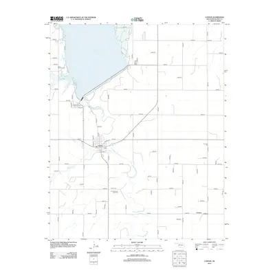
2012 Map of Canton
USGS Topo · Published 2012About this map
The North Canadian River valley and the expansive waters of Canton Lake define this western Oklahoma landscape. The town of Canton serves as the local hub, situated just south of the lake’s massive dam. This region carries deep cultural roots, evidenced by several specialized burial grounds such as the Cantonment Reinterment Cem and the Indian Mennonite Cem northwest of town. The map provides a detailed view of the grid-patterned township roads that intersect the prairie, including the crossing of Santa Fe RD. Further south, the rural settlement areas of Carleton and Carlton appear along the river's meandering course, while smaller tributaries like Minnehaha Cr wind through the surrounding plains. The clustering of sites like the Zion Mennonite Indian Cem reflects the area's specific heritage at the intersection of local industry and tribal history.
Find a feature on this map
60 named features on this map. Tap any name to fly to it.
Don’t see what you’re looking for? This feature index may not catch every label — zoom into the map to look around manually.
Map Details
Editions of this 2012 Canton Map
This is the sole edition of this map. No revisions or reprints were ever made.
Other maps of this area

1955 · Clinton
USGS Topo · 1:250,000

1955 · Woodward
USGS Topo · 1:250,000

1957 · Clinton
USGS Topo · 1:250,000

1958 · Woodward
USGS Topo · 1:250,000

1964 · Oakwood
USGS Topo · 1:62,500

1972 · Longdale
USGS Topo · 1:24,000

1972 · Canton NW
USGS Topo · 1:24,000

1972 · Canton
USGS Topo · 1:24,000

1972 · Canton SW
USGS Topo · 1:24,000

1972 · Southard
USGS Topo · 1:24,000