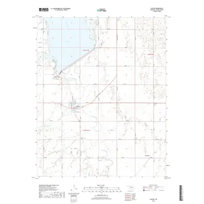
2018 Map of Canton
USGS Topo · Published 2018About this map
The North Canadian River flows southeast through this portion of Blaine County, dominated by the waters of Canton Lake and the established town of Canton. This 2018 survey documents the community's street grid, including E Main St and N Broadway, while recording the rural landscape to the east and south. Significant local history sites are noted, including the Cantonment Reinterment Cem near the lake’s edge and the rural Carleton settlement area to the southeast. The hydrology of the region is further defined by Minnehaha Cr, which feeds into the river system below the dam. Other genealogical landmarks like Canton Cem and Cherryvale Cem provide specific points of interest for those tracing family roots in this central Oklahoma region.
Find a feature on this map
49 named features on this map. Tap any name to fly to it.
Don’t see what you’re looking for? This feature index may not catch every label — zoom into the map to look around manually.
Map Details
Editions of this 2018 Canton Map
This is the sole edition of this map. No revisions or reprints were ever made.
Other maps of this area

1955 · Clinton
USGS Topo · 1:250,000

1955 · Woodward
USGS Topo · 1:250,000

1957 · Clinton
USGS Topo · 1:250,000

1958 · Woodward
USGS Topo · 1:250,000

1964 · Oakwood
USGS Topo · 1:62,500

1972 · Longdale
USGS Topo · 1:24,000

1972 · Canton NW
USGS Topo · 1:24,000

1972 · Canton
USGS Topo · 1:24,000

1972 · Canton SW
USGS Topo · 1:24,000

1972 · Southard
USGS Topo · 1:24,000