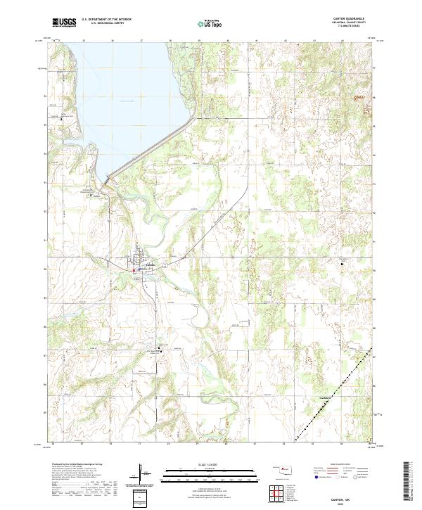
2022 Map of Canton
USGS Topo · Published 2022About this map
Canton Lake dominates the northern landscape of this Oklahoma survey, where the North Canadian River is impounded just upstream from the town of Canton. The map reveals a high density of specialized burial grounds that reflect the complex cultural history of the region, including the Indian Mennonite Cem, the Cantonment Reinterment Cem, and the Zion Mennonite Indian Cem. To the south, the smaller settlement of Carleton sits along a grid of section roads like e0690 RD. The winding path of the N Canadian River and its tributary Minnehaha Cr provide the primary geographic relief against the structured agricultural blocks of Blaine County.
Find a feature on this map
35 named features on this map. Tap any name to fly to it.
Don’t see what you’re looking for? This feature index may not catch every label — zoom into the map to look around manually.
Map Details
Editions of this 2022 Canton Map
This is the sole edition of this map. No revisions or reprints were ever made.
Other maps of this area

1955 · Clinton
USGS Topo · 1:250,000

1955 · Woodward
USGS Topo · 1:250,000

1957 · Clinton
USGS Topo · 1:250,000

1958 · Woodward
USGS Topo · 1:250,000

1964 · Oakwood
USGS Topo · 1:62,500

1972 · Longdale
USGS Topo · 1:24,000

1972 · Canton NW
USGS Topo · 1:24,000

1972 · Canton
USGS Topo · 1:24,000

1972 · Canton SW
USGS Topo · 1:24,000

1972 · Southard
USGS Topo · 1:24,000