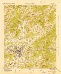
1942 Map of Canton
USGS Topo · Published 1942About this map
Canton and its industrial neighbor Fiberville anchor this mountain landscape, where the Pigeon River bends through the valley floor. During the early 1940s, this area of Haywood County shows a dense network of rural community centers, with family-named locations such as Arnan Plains and Sunnypoint scattered among the ridges. The Southern railroad line follows the course of Hominy Creek, connecting the mill town to the broader region. Higher elevations are defined by the Newfound Mountains and the Pisgah National Forest, where smaller settlements like Morning Star and Turnpike sit along winding mountain roads. Genealogists will find a wealth of local landmarks, from the Henderson Cem and Clark Cem to numerous country churches including Browns Chapel and Liberty Ch. The map also captures the local infrastructure of the era, such as the Canton Reservoir and the Beaverdam School.
Find a feature on this map
103 named features on this map. Tap any name to fly to it.
Don’t see what you’re looking for? This feature index may not catch every label — zoom into the map to look around manually.
Map Details
Editions of this 1942 Canton Map
2 editions found

Other maps of this area

1894 · Asheville
USGS Topo · 1:125,000

1901 · Asheville
USGS Topo · 1:125,000

1905 · Pisgah
USGS Topo · 1:125,000

1906 · Pisgah
USGS Topo · 1:125,000

1935 · Cruso
USGS Topo · 1:24,000

1935 · Waynesville
USGS Topo · 1:24,000

1935 · Canton
USGS Topo · 1:24,000

1935 · Clyde
USGS Topo · 1:24,000

1936 · Sandymush
USGS Topo · 1:24,000

1936 · Enka
USGS Topo · 1:24,000