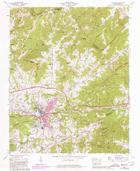
1967 Map of Canton
USGS Topo · Published 1980About this map
Industrial and residential development along the Pigeon River characterizes this late 1960s study of the region, featuring the mill-adjacent community of Fibreville and the expansion at West Canton. The town of Canton serves as the economic hub, anchored by the Southern Railway corridor and significant industrial infrastructure like the large Settling tanks. Beyond the river valley, the terrain rises into the Pisgah National Forest and the peaks of Newfound Mountain. Genealogy and local history are well-represented by numerous rural landmarks, including the Henderson Cem and Smathers Cem, alongside community centers such as Oak Grove Ch and Morning Star. The map also captures the path of Interstate 40 as it began to reshape local transportation patterns through Newfound Gap and Turkey Creek Gap.
Find a feature on this map
126 named features on this map. Tap any name to fly to it.
Don’t see what you’re looking for? This feature index may not catch every label — zoom into the map to look around manually.
Map Details
Editions of this 1967 Canton Map
4 editions found
Other maps of this area

1894 · Asheville
USGS Topo · 1:125,000

1901 · Asheville
USGS Topo · 1:125,000

1905 · Pisgah
USGS Topo · 1:125,000

1906 · Pisgah
USGS Topo · 1:125,000

1935 · Cruso
USGS Topo · 1:24,000

1935 · Waynesville
USGS Topo · 1:24,000

1935 · Canton
USGS Topo · 1:24,000

1935 · Clyde
USGS Topo · 1:24,000

1936 · Sandymush
USGS Topo · 1:24,000

1936 · Enka
USGS Topo · 1:24,000