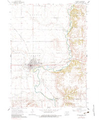
1962 Map of Canton
USGS Topo · Published 1983About this map
The Big Sioux River snakes along the border of South Dakota and Iowa, defining the eastern edge of Canton and the small settlement of Beloit. This landscape in the early 1960s reflects a well-established agrarian and educational hub, centered around the Augustana Academy and the Canton Municipal Hospital. The rail-centered economy is evident as the Chicago Milwaukee St Paul and Pacific railroad bisects the terrain, connecting the river valley to the surrounding townships of Dayton, Canton, and Highland.
Find a feature on this map
35 named features on this map. Tap any name to fly to it.
Don’t see what you’re looking for? This feature index may not catch every label — zoom into the map to look around manually.
Map Details
Editions of this 1962 Canton Map
2 editions found
Other maps of this area

1897 · Canton
USGS Topo · 1:125,000

1900 · Canton
USGS Topo · 1:125,000

1955 · Sioux Falls
USGS Topo · 1:250,000

1958 · Sioux Falls
USGS Topo · 1:250,000

1962 · Klondike
USGS Topo · 1:24,000

1962 · Harrisburg
USGS Topo · 1:24,000

1962 · Canton
USGS Topo · 1:24,000

1964 · Canton SW
USGS Topo · 1:24,000

1968 · Alcester NW
USGS Topo · 1:24,000

1968 · Alcester NE
USGS Topo · 1:24,000