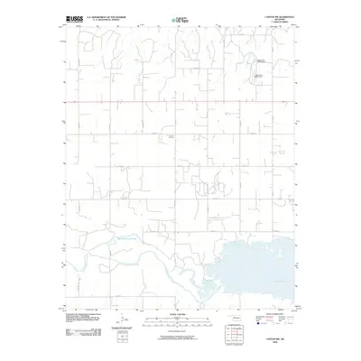
2009 Map of Canton NW
USGS Topo · Published 2009About this map
The North Canadian River meanders through this section of Major County, feeding into the northern reaches of Canton Lake. This 2009 landscape is defined by the transition from riverine wetlands to a rigid grid of rural roads, including E0530 Rd and N2390 Rd. Near the center of the survey, Fern Cliff Cemetery serves as a significant genealogical marker for local families. The hydrology of the area is further modified by water management features like Oknoname 093006 Dam and Oknoname 093007 Dam to the north. Near the river's bend, Red Bluff Cutoff Lake indicates the shifting nature of the river channel over time, while Cheyenne Creek drains the northern sections toward the valley floor.
Find a feature on this map
23 named features on this map. Tap any name to fly to it.
Don’t see what you’re looking for? This feature index may not catch every label — zoom into the map to look around manually.
Map Details
Editions of this 2009 Canton NW Map
This is the sole edition of this map. No revisions or reprints were ever made.
Other maps of this area

1955 · Woodward
USGS Topo · 1:250,000

1958 · Woodward
USGS Topo · 1:250,000

1969 · Phroso
USGS Topo · 1:24,000

1969 · Glass Mountains
USGS Topo · 1:24,000

1969 · Glass Mountains SW
USGS Topo · 1:24,000

1972 · Longdale
USGS Topo · 1:24,000

1972 · Canton NW
USGS Topo · 1:24,000

1972 · Canton
USGS Topo · 1:24,000

1972 · Hucmac
USGS Topo · 1:24,000

1972 · Canton SW
USGS Topo · 1:24,000