
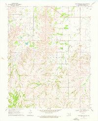
1969 Map of Glass Mountains SW
USGS Topo · Published 1971About this map
The Northeast Cheyenne Valley Field defines the industrial character of this corner of Major County during the late 1960s. The landscape is a network of energy infrastructure, marked by numerous Oil Wells, Gas Wells, and a prominent Pipeline that cuts across the terrain. Amidst this active extraction field, local history is anchored at the Lone Star Cem in the northwestern quadrant, a common sight in Oklahoma's rural sections where family and community burial grounds often predate the surrounding industry.
Find a feature on this map
15 named features on this map. Tap any name to fly to it.
Don’t see what you’re looking for? This feature index may not catch every label — zoom into the map to look around manually.
Map Details
Editions of this 1969 Glass Mountains SW Map
2 editions found
Other maps of this area

1955 · Woodward
USGS Topo · 1:250,000

1958 · Woodward
USGS Topo · 1:250,000

1969 · Phroso
USGS Topo · 1:24,000

1969 · Glass Mountains NW
USGS Topo · 1:24,000

1969 · Glass Mountains
USGS Topo · 1:24,000

1969 · Glass Mountains NE
USGS Topo · 1:24,000

1969 · Togo
USGS Topo · 1:24,000

1972 · Longdale
USGS Topo · 1:24,000

1972 · Canton NW
USGS Topo · 1:24,000
1972 · Orion
USGS Topo · 1:24,000