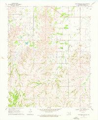
1969 Map of Glass Mountains SW
USGS Topo · Published 1976About this map
Cheyenne Valley and its local landmarks are documented in this late-1960s survey of Major County. The landscape is defined by the development of the Northeast Cheyenne Valley Oil Field and the East Cheyenne Gas Field, indicating a period of significant petroleum extraction across this part of Oklahoma. Evidence of earlier settlement remains visible through the presence of the Cheyenne Valley Ch and the Lone Star Cem near the northern boundary. The terrain is marked by distinctive elevations like Tepee Mountain, while the drainage pattern is established by the West Branch Barney Creek and Cheyenne Creek. This map preserves the mid-century footprint of rural communities and the industrial infrastructure of the Allen Oil Field before later modernizations altered the local character.
Find a feature on this map
16 named features on this map. Tap any name to fly to it.
Don’t see what you’re looking for? This feature index may not catch every label — zoom into the map to look around manually.
Map Details
Editions of this 1969 Glass Mountains SW Map
2 editions found
Other maps of this area

1955 · Woodward
USGS Topo · 1:250,000

1958 · Woodward
USGS Topo · 1:250,000

1969 · Phroso
USGS Topo · 1:24,000

1969 · Glass Mountains NW
USGS Topo · 1:24,000

1969 · Glass Mountains
USGS Topo · 1:24,000

1969 · Glass Mountains NE
USGS Topo · 1:24,000

1969 · Togo
USGS Topo · 1:24,000

1969 · Glass Mountains SW
USGS Topo · 1:24,000

1972 · Longdale
USGS Topo · 1:24,000

1972 · Canton NW
USGS Topo · 1:24,000