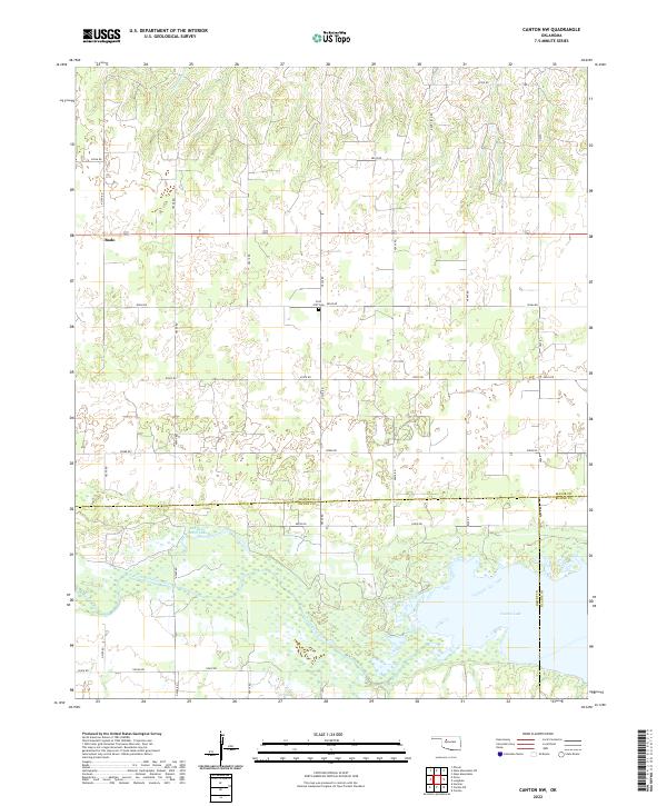
2022 Map of Canton NW
USGS Topo · Published 2022About this map
Canton Lake dominates the southern landscape of this Oklahoma region, where the North Canadian River feeds into the reservoir across the borders of Major, Dewey, and Blaine counties. The topography here is defined by the river's broad floodplain and the intricate wetland systems surrounding Red Bluff Cutoff Lake. Further north, the land rises into upland plains marked by a strict section-line road grid, including Indian Rd and Dane Field Rd, which serve the rural homesteads of the area. The small settlement of Bado sits in the northwest corner, a quiet hub for the surrounding agricultural community. For those tracing local heritage, the Fern Cliff Cem provides a specific point of genealogical interest, situated amidst the fields and small drainages like Cheyenne Cr.
Find a feature on this map
34 named features on this map. Tap any name to fly to it.
Don’t see what you’re looking for? This feature index may not catch every label — zoom into the map to look around manually.
Map Details
Editions of this 2022 Canton NW Map
This is the sole edition of this map. No revisions or reprints were ever made.
Other maps of this area

1955 · Woodward
USGS Topo · 1:250,000

1958 · Woodward
USGS Topo · 1:250,000

1969 · Phroso
USGS Topo · 1:24,000

1969 · Glass Mountains
USGS Topo · 1:24,000

1969 · Glass Mountains SW
USGS Topo · 1:24,000

1972 · Longdale
USGS Topo · 1:24,000

1972 · Canton NW
USGS Topo · 1:24,000

1972 · Canton
USGS Topo · 1:24,000

1972 · Hucmac
USGS Topo · 1:24,000

1972 · Canton SW
USGS Topo · 1:24,000