
1972 Map of Canton NW
USGS Topo · Published 1974About this map
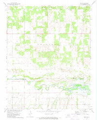
Canton Lake dominates the southern landscape of this 1970s survey, marking a significant hydrological feature where the North Canadian River is impounded. The map provides a detailed view of the surrounding riparian environment, including the Red Bluff Cutoff Lake and the expansive State Game Management Area. The terrain transitions from the river valley into the upland prairies of Major and Dewey Counties, where small rural nodes like Bado and community landmarks such as Midway Ch and Fern Cliff Cem anchor the local geography.
Find a feature on this map
22 named features on this map. Tap any name to fly to it.
Don’t see what you’re looking for? This feature index may not catch every label — zoom into the map to look around manually.
Map Details
Editions of this 1972 Canton NW Map
This is the sole edition of this map. No revisions or reprints were ever made.
Other maps of this area

1955 · Woodward
USGS Topo · 1:250,000

1958 · Woodward
USGS Topo · 1:250,000

1969 · Phroso
USGS Topo · 1:24,000

1969 · Glass Mountains
USGS Topo · 1:24,000

1969 · Glass Mountains SW
USGS Topo · 1:24,000

1972 · Longdale
USGS Topo · 1:24,000

1972 · Canton
USGS Topo · 1:24,000

1972 · Hucmac
USGS Topo · 1:24,000

1972 · Canton SW
USGS Topo · 1:24,000
1972 · Orion
USGS Topo · 1:24,000