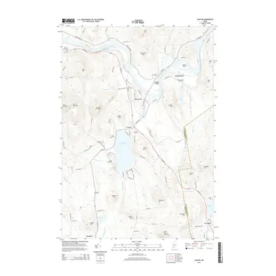
2014 Map of Canton
USGS Topo · Published 2014About this map
The Androscoggin River winds through this landscape, carving a wide valley between several prominent hills and mountains. Small settlements like Canton, Gilbertville, and Meadowview are centered around the river and the expansive Lake Anasagunticook. For genealogists, the map is a dense resource of family history markers, featuring numerous small burial grounds including Pine Grove Cem, Deshon Cem, and Leavitt Cem. The terrain is characterized by distinct peaks such as Trask Mountain, Thorne Mountain, and the steep Dunn Ledge. This survey provides a clear view of the transportation network connecting these communities across the Oxford and Androscoggin county line, from the primary corridor of Auburn Rd to the more remote paths of Alden Hill Rd near the eastern boundary.
Find a feature on this map
109 named features on this map. Tap any name to fly to it.
Don’t see what you’re looking for? This feature index may not catch every label — zoom into the map to look around manually.
Map Details
Editions of this 2014 Canton Map
This is the sole edition of this map. No revisions or reprints were ever made.
Other maps of this area

1910 · Livermore
USGS Topo · 1:62,500

1911 · Buckfield
USGS Topo · 1:62,500

1912 · Livermore
USGS Topo · 1:62,500

1913 · Buckfield
USGS Topo · 1:62,500

1924 · Farmington
USGS Topo · 1:62,500

1926 · Dixfield
USGS Topo · 1:62,500

1929 · Dixfield
USGS Topo · 1:62,500

1941 · Livermore
USGS Topo · 1:62,500

1942 · Buckfield
USGS Topo · 1:62,500

1950 · Lewiston
USGS Topo · 1:250,000