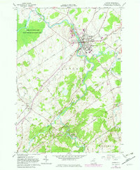
1964 Map of Canton
USGS Topo · Published 1982About this map
Canton serves as the academic and civic hub of this St. Lawrence County landscape, anchored by the campuses of St Lawrence University and the State Univ of NY Agr and Tech College. The town is defined by the winding course of the Grass River, which flows past numerous burial grounds including Evergreen Cem and Fairview Cem. To the northwest, the extensive Upper and Lower Lakes State Wildlife Management Area dominates the terrain, while smaller settlements like Eddy and Pyrites dot the southern reaches near the junction of Harrison Creek. The 1980s-era revisions, marked in purple, document suburban expansion and infrastructure updates such as the Drive-in Theater and various Gravel Pits. This period shows a transition from a rail-dependent economy along the Conrail line to one increasingly shaped by university growth and modern road networks like State Road.
Find a feature on this map
59 named features on this map. Tap any name to fly to it.
Don’t see what you’re looking for? This feature index may not catch every label — zoom into the map to look around manually.
Map Details
Editions of this 1964 Canton Map
2 editions found
Other maps of this area

1904 · Ogdensburg
USGS Topo · 1:62,500

1905 · Ogdensburg
USGS Topo · 1:62,500

1910 · Canton
USGS Topo · 1:62,500

1911 · Canton
USGS Topo · 1:62,500

1915 · Gouverneur
USGS Topo · 1:62,500

1915 · Russell
USGS Topo · 1:62,500

1918 · Russell
USGS Topo · 1:62,500

1937 · Gouverneur
USGS Topo · 1:62,500

1943 · Rensselaer Falls
USGS Topo · 1:31,680

1943 · Lisbon
USGS Topo · 1:31,680