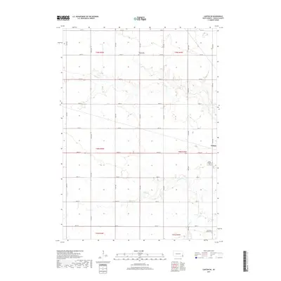
2017 Map of Canton SW
USGS Topo · Published 2017About this map
Beaver Cr and its tributaries wind through the agricultural landscape of Lincoln County in this 2017 survey of the plains southwest of Canton. The map captures a highly organized township-and-range system, where a grid of gravel and paved roads like 474th Ave and 282nd St defines the rural character. This layout reflects the enduring legacy of the Public Land Survey System in South Dakota, where sections are clearly delineated for farming and land ownership. Genealogy and local history are anchored by several notable burial grounds, including the Beaver Creek Lutheran Cem to the north and the Grand Valley Lutheran Cem at the southern edge of the quadrangle. Near the eastern border, Forest Hill Cem sits just outside the expanding footprint of Canton, marking a quiet transition between the town and the vast prairie drainage of S Beaver Cr.
Find a feature on this map
29 named features on this map. Tap any name to fly to it.
Don’t see what you’re looking for? This feature index may not catch every label — zoom into the map to look around manually.
Map Details
Editions of this 2017 Canton SW Map
This is the sole edition of this map. No revisions or reprints were ever made.
Other maps of this area

1897 · Canton
USGS Topo · 1:125,000

1900 · Canton
USGS Topo · 1:125,000

1955 · Sioux Falls
USGS Topo · 1:250,000

1958 · Sioux Falls
USGS Topo · 1:250,000

1962 · Klondike
USGS Topo · 1:24,000

1962 · Harrisburg
USGS Topo · 1:24,000

1962 · Canton
USGS Topo · 1:24,000

1962 · Tea
USGS Topo · 1:24,000

1964 · Canton SW
USGS Topo · 1:24,000

1964 · Worthing
USGS Topo · 1:24,000