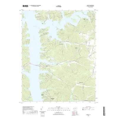
2019 Map of Canton
USGS Topo · Published 2019About this map
Lake Barkley dominates this Trigg County landscape, its sprawling waters defining the character of western Kentucky. The settlement of Canton sits at a strategic crossing, where the Lawrence Memorial Bridge connects the eastern shore to the Land Between the Lakes region. The map reveals a transition from these historical river-bottom lands to modern lakeside developments like Shawnee Hills, Barkley Shores, and Cumberland Shores.
Find a feature on this map
139 named features on this map. Tap any name to fly to it.
Don’t see what you’re looking for? This feature index may not catch every label — zoom into the map to look around manually.
Map Details
Editions of this 2019 Canton Map
This is the sole edition of this map. No revisions or reprints were ever made.
Other maps of this area

1936 · Mont
USGS Topo · 1:24,000

1936 · Fenton
USGS Topo · 1:24,000

1936 · Golden Pond
USGS Topo · 1:48,000

1936 · Rushing
USGS Topo · 1:24,000

1950 · Rushing Creek
USGS Topo · 1:24,000
1950 · Mont
USGS Topo · 1:24,000
1950 · Fenton
USGS Topo · 1:24,000

1951 · Model
USGS Topo · 1:24,000

1951 · Johnson Hollow
USGS Topo · 1:24,000

1953 · Canton
USGS Topo · 1:24,000