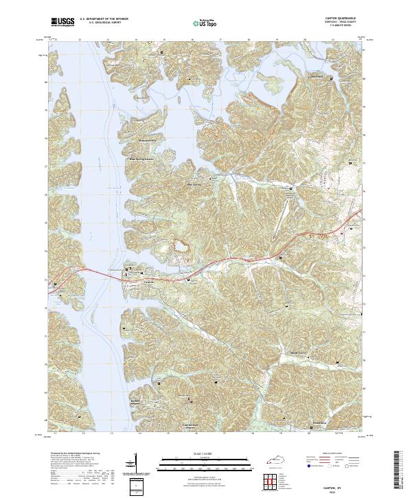
2022 Map of Canton
USGS Topo · Published 2022About this map
The waters of Lake Barkley dominate this portion of Trigg County, Kentucky, where the flooded valley of the Cumberland River defines the local geography. Along the irregular eastern shoreline, the settlement of Canton remains a focal point, anchored by the Canton Baptist Church and a high density of family burial grounds. The map reveals an intricate network of modern residential developments like Blue Spring Estates, Barkley Shores, and Shawnee Hills that have grown up around the reservoir's inlets, such as Pond Bay and Elbow Bay.
Find a feature on this map
153 named features on this map. Tap any name to fly to it.
Don’t see what you’re looking for? This feature index may not catch every label — zoom into the map to look around manually.
Map Details
Editions of this 2022 Canton Map
This is the sole edition of this map. No revisions or reprints were ever made.
Other maps of this area

1936 · Mont
USGS Topo · 1:24,000

1936 · Fenton
USGS Topo · 1:24,000

1936 · Golden Pond
USGS Topo · 1:48,000

1936 · Rushing
USGS Topo · 1:24,000

1950 · Rushing Creek
USGS Topo · 1:24,000
1950 · Mont
USGS Topo · 1:24,000
1950 · Fenton
USGS Topo · 1:24,000

1951 · Model
USGS Topo · 1:24,000

1951 · Johnson Hollow
USGS Topo · 1:24,000

1953 · Canton
USGS Topo · 1:24,000