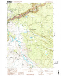
1986 Map of Canyon Village
USGS Topo · Published 1986About this map
Canyon Village serves as the primary gateway to one of nature's most significant carvings in this 1980s-era study of Yellowstone National Park. The landscape is dominated by the Grand Canyon of the Yellowstone, where the Yellowstone River plunges over Upper Falls and Lower Falls. This period of the park’s history is meticulously documented, showing the layout of the Campground, Trailer Park, and the essential Sewage Disposal Plant supporting the seasonal population. To the south, the terrain shifts into the hydrothermal activity of the Crater Hills, featuring thermal landmarks like Sulphur Caldron and Dragons Mouth Spring. The map also traces an extensive network of a Pack Trail that connects isolated spots like Point Sublime and Ribbon Lake to the more developed visitor hubs at Canyon Junction.
Find a feature on this map
40 named features on this map. Tap any name to fly to it.
Don’t see what you’re looking for? This feature index may not catch every label — zoom into the map to look around manually.
Map Details
Editions of this 1986 Canyon Village Map
This is the sole edition of this map. No revisions or reprints were ever made.
Other maps of this area

1885 · Gallatin
USGS Topo · 1:125,000

1885 · Gallatin
USGS Topo · 1:125,000

1886 · Canyon
USGS Topo · 1:125,000

1895 · Canyon
USGS Topo · 1:125,000

1896 · Canyon
USGS Topo · 1:125,000

1901 · Canyon
USGS Topo · 1:125,000

1901 · Gallatin
USGS Topo · 1:125,000

1907 · Canyon
USGS Topo · 1:125,000

1908 · Gallatin
USGS Topo · 1:125,000

1911 · Gallatin
USGS Topo · 1:125,000