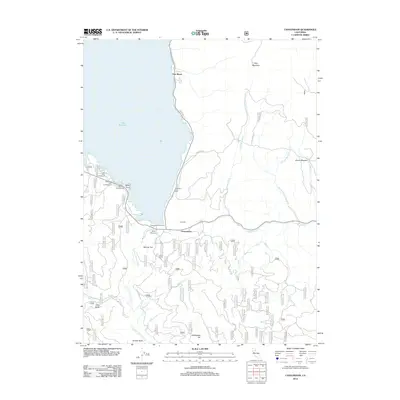
2012 Map of Canyondam
USGS Topo · Published 2012About this map
Lake Almanor dominates the western half of this landscape, its shoreline dotted with recreational sites like Fox Farm Campground, Mountain View Campground, and the Eastshore Picnic Area. The settlement of Canyondam sits at the southern reach of the lake, serving as a hub near where the N Fork Feather River begins its descent through the mountains. To the east, the terrain rises toward Dyer Mountain and Hauns Meadow, a region marked by a dense network of forest roads such as Old Haun Rd and Rush Hill Mtwy. The southeastern portion of the map reveals a rugged drainage system where Wolf Cr and Clear Cr carve through the high country. Small, isolated flats and valleys like Skinner Flat and Ohio Valley provide a sense of the early settlement patterns that preceded the more modern developments at East Shore.
Find a feature on this map
76 named features on this map. Tap any name to fly to it.
Don’t see what you’re looking for? This feature index may not catch every label — zoom into the map to look around manually.
Map Details
Editions of this 2012 Canyondam Map
This is the sole edition of this map. No revisions or reprints were ever made.
Other maps of this area

1886 · Honey Lake
USGS Topo · 1:250,000

1886 · Lassen Peak
USGS Topo · 1:250,000

1891 · Honey Lake
USGS Topo · 1:250,000

1892 · Lassen Peak
USGS Topo · 1:250,000

1893 · Honey Lake
USGS Topo · 1:250,000

1894 · Lassen Peak
USGS Topo · 1:250,000

1950 · Greenville
USGS Topo · 1:62,500

1955 · Westwood
USGS Topo · 1:62,500

1955 · Almanor
USGS Topo · 1:62,500

1955 · Westwood
USGS Topo · 1:250,000