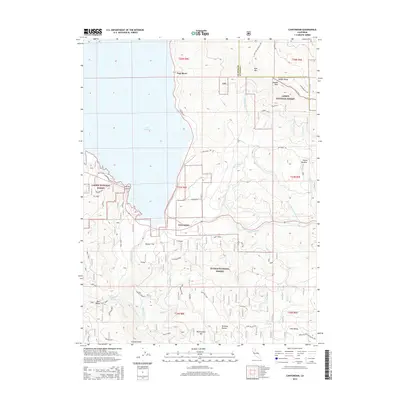
2015 Map of Canyondam
USGS Topo · Published 2015About this map
Lake Almanor and its complex eastern shoreline dominate this 2015 study, where the waters of the N Fork Feather River meet the rising slopes of the Sierra Nevada. The settlement of Canyondam sits at the southern edge of the lake, serving as a gateway between the Lassen National Forest and Plumas National Forest. The map detail reveals an intricate network of forest service roads and spurs, such as the Almanor Spur and Rattle Snake Spur, which navigate the steep transition from the water’s edge to high points like Dyer Mtn.
Find a feature on this map
53 named features on this map. Tap any name to fly to it.
Don’t see what you’re looking for? This feature index may not catch every label — zoom into the map to look around manually.
Map Details
Editions of this 2015 Canyondam Map
This is the sole edition of this map. No revisions or reprints were ever made.
Other maps of this area

1886 · Honey Lake
USGS Topo · 1:250,000

1886 · Lassen Peak
USGS Topo · 1:250,000

1891 · Honey Lake
USGS Topo · 1:250,000

1892 · Lassen Peak
USGS Topo · 1:250,000

1893 · Honey Lake
USGS Topo · 1:250,000

1894 · Lassen Peak
USGS Topo · 1:250,000

1950 · Greenville
USGS Topo · 1:62,500

1955 · Westwood
USGS Topo · 1:62,500

1955 · Almanor
USGS Topo · 1:62,500

1955 · Westwood
USGS Topo · 1:250,000