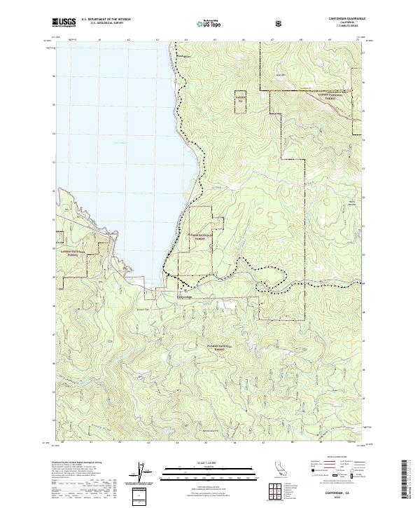
2022 Map of Canyondam
USGS Topo · Published 2022About this map
Lake Almanor dominates the western portion of this landscape, its shoreline defining the limits of settlements like Canyondam and East Shore. The map reveals a transition from the deep waters of the reservoir to the high elevations of Dyer Mtn and Keddie Ridge, where the terrain is marked by traditional land use names such as Hauns Meadow and Skinner Flat. The drainage system is particularly intricate south of the lake, where the N Fork Feather River is joined by numerous named tributaries including Pliocene Cr, Salmon Cr, and Davis Cr. This network of creeks and gulches, such as Grizzly Gulch, reflects the complex topography of the Lassen National Forest and Plumas National Forest boundary. Local transit is centered on the Lake Almanor Eastside Rd, providing access to landmarks like Rocky Point and the timber-rich slopes of the surrounding Sierras.
Find a feature on this map
37 named features on this map. Tap any name to fly to it.
Don’t see what you’re looking for? This feature index may not catch every label — zoom into the map to look around manually.
Map Details
Editions of this 2022 Canyondam Map
This is the sole edition of this map. No revisions or reprints were ever made.
Other maps of this area

1886 · Honey Lake
USGS Topo · 1:250,000

1886 · Lassen Peak
USGS Topo · 1:250,000

1891 · Honey Lake
USGS Topo · 1:250,000

1892 · Lassen Peak
USGS Topo · 1:250,000

1893 · Honey Lake
USGS Topo · 1:250,000

1894 · Lassen Peak
USGS Topo · 1:250,000

1950 · Greenville
USGS Topo · 1:62,500

1955 · Westwood
USGS Topo · 1:62,500

1955 · Almanor
USGS Topo · 1:62,500

1955 · Westwood
USGS Topo · 1:250,000