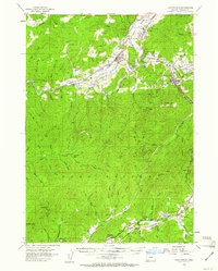
1954 Map of Canyonville
USGS Topo · Published 1961About this map
Riddle and Canyonville anchor this mid-century survey of the South Umpqua River valley, where the Southern Pacific railroad and the Pacific Highway parallel the winding water. The landscape is defined by its industrial and conservation history, notably the Nickel Mtn mine and the extensive Cow Creek Game Refuge. To the south, the map documents smaller timber and rail-aligned settlements like Azalea, Cornutt, and Glendale Junction, along with the Galesville (Site). Steep terrain rises toward Canyon Mtn and Tellurium Peak, marked by numerous trails and resource extraction sites such as the Gold Bluff Mine. This 1954 data reflects a moment when traditional mountain economies like mining and logging were the primary drivers of settlement patterns throughout the Missouri Bottom and along the various forks of Cow Creek.
Find a feature on this map
83 named features on this map. Tap any name to fly to it.
Don’t see what you’re looking for? This feature index may not catch every label — zoom into the map to look around manually.
Map Details
Editions of this 1954 Canyonville Map
2 editions found

Other maps of this area

1897 · Roseburg
USGS Topo · 1:125,000

1900 · Roseburg
USGS Topo · 1:125,000

1904 · Riddle
USGS Topo · 1:125,000

1928 · Sitkum
USGS Topo · 1:125,000

1946 · Galice
USGS Topo · 1:62,500

1946 · Dutchman Butte
USGS Topo · 1:62,500

1948 · Galice
USGS Topo · 1:62,500

1948 · Dutchman Butte
USGS Topo · 1:62,500

1954 · Dixonville
USGS Topo · 1:62,500

1954 · Days Creek
USGS Topo · 1:62,500