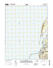
2016 Map of Cape Charles
USGS Topo · Published 2016About this map
Cape Charles anchors the southern tip of the Delmarva Peninsula on this coastal survey, where the terrestrial landscape meets the deep waters of the Chesapeake Bay. The town is mapped in high detail, showing its distinctive grid including Bay Ave, Strawberry St, and Nectarine St, which terminates near the Cape Charles Harbor. This region represents a vital intersection of maritime navigation and local agriculture, with the Intracoastal Waterway and York Spit Channel facilitating shipping while inland ponds like Nassawango Mill Pond and Purnell Pond dot the low-lying interior.
Find a feature on this map
42 named features on this map. Tap any name to fly to it.
Don’t see what you’re looking for? This feature index may not catch every label — zoom into the map to look around manually.
Map Details
Editions of this 2016 Cape Charles Map
This is the sole edition of this map. No revisions or reprints were ever made.
Other maps of this area

1942 · Cheriton
USGS Topo · 1:24,000

1943 · Elliots Creek
USGS Topo · 1:25,000

1943 · Townsend
USGS Topo · 1:24,000

1943 · Franktown
USGS Topo · 1:31,680

1943 · Richmond
USGS Topo · 1:250,000

1946 · Eastville
USGS Topo · 1:250,000

1948 · Cape Charles
USGS Topo · 1:24,000

1949 · Richmond
USGS Topo · 1:250,000
1955 · Elliotts Creek
USGS Topo · 1:24,000
1955 · Cape Charles
USGS Topo · 1:24,000