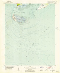
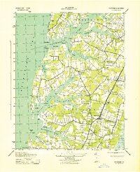
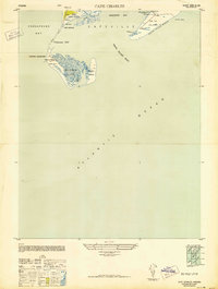
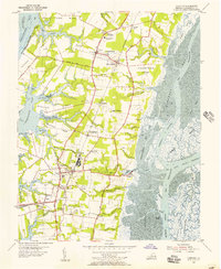
1955 Map of Cape Charles
USGS Topo · Published 1956About this map
The southern tip of the Delmarva Peninsula at Cape Charles serves as a critical strategic landscape where the Chesapeake Bay meets the Atlantic Ocean. This mid-1950s survey highlights the heavy military and maritime presence during the Cold War era, featuring both the Fisherman Island Naval Base and the Cape Charles Air Force Base. The map reveals a complex network of coastal features and hazards, from the shifting sands of Smith Island to the intricate waterways of Smith Island Inlet and Fisherman Inlet.
Find a feature on this map
19 named features on this map. Tap any name to fly to it.
Don’t see what you’re looking for? This feature index may not catch every label — zoom into the map to look around manually.
Map Details
Editions of this 1955 Cape Charles Map
2 editions found
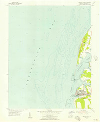
Other maps of this area
1942 · Cheriton
USGS Topo · 1:24,000
1943 · Elliots Creek
USGS Topo · 1:25,000

1943 · Townsend
USGS Topo · 1:24,000
1943 · Franktown
USGS Topo · 1:31,680

1943 · Richmond
USGS Topo · 1:250,000

1946 · Eastville
USGS Topo · 1:250,000
1948 · Cape Charles
USGS Topo · 1:24,000

1949 · Richmond
USGS Topo · 1:250,000

1955 · Elliotts Creek
USGS Topo · 1:24,000
1955 · Cheriton
USGS Topo · 1:24,000