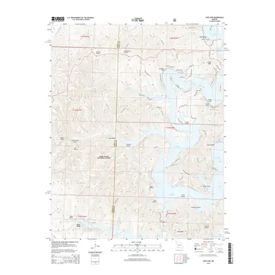
2015 Map of Cape Fair
USGS Topo · Published 2015About this map
Table Rock Lake dominates this portion of the Ozark Plateau, its deeply indented shoreline forming numerous points and coves across the Barry and Stone County line. The terrain is characterized by a dense network of named hollows, such as Wildcat Hollow and Wolfpen Hollow, which drain into the reservoir's primary arms. Prominent topographical features like Virgin Bluff and Long Bend Bluff rise above the water, marking the original course of the river before the lake's inundation.
Find a feature on this map
86 named features on this map. Tap any name to fly to it.
Don’t see what you’re looking for? This feature index may not catch every label — zoom into the map to look around manually.
Map Details
Editions of this 2015 Cape Fair Map
This is the sole edition of this map. No revisions or reprints were ever made.
Other maps of this area

1907 · Forsyth
USGS Topo · 1:125,000

1927 · Shell Knob
USGS Topo · 1:62,500

1942 · Aurora
USGS Topo · 1:62,500

1945 · Harrison
USGS Topo · 1:250,000

1945 · Aurora
USGS Topo · 1:62,500

1949 · Harrison
USGS Topo · 1:250,000

1950 · Shell Knob
USGS Topo · 1:62,500

1954 · Harrison
USGS Topo · 1:250,000

1956 · Lampe
USGS Topo · 1:24,000
1956 · Reeds Spring
USGS Topo · 1:24,000