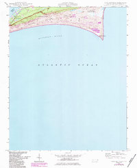
1948 Map of Cape Hatteras
USGS Topo · Published 1983About this map
Cape Hatteras stands as the prominent focal point of this coastal study, marking the sharp eastern bend of Hatteras Island. The landscape is a narrow ribbon of sand and marsh caught between the shallow waters of Pamlico Sound and the open Atlantic Ocean. The village of Frisco and the landmark Little Grove Ch represent the small-scale settlement patterns that persisted even as the area transitioned toward conservation and recreation.
Find a feature on this map
14 named features on this map. Tap any name to fly to it.
Don’t see what you’re looking for? This feature index may not catch every label — zoom into the map to look around manually.
Map Details
Editions of this 1948 Cape Hatteras Map
3 editions found
Other maps of this area

1948 · Cape Hatteras
USGS Topo · 1:24,000

1948 · Buxton
USGS Topo · 1:24,000

1950 · Cape Hatteras
USGS Topo · 1:24,000

1950 · Buxton
USGS Topo · 1:24,000

1955 · Wanchese
USGS Topo · 1:250,000

1957 · Manteo
USGS Topo · 1:250,000

1960 · Manteo
USGS Topo · 1:250,000

1985 · Cape Hatteras
USGS Topo · 1:100,000

2002 · Cape Hatteras
USGS Topo · 1:24,000

2011 · Buxton
USGS Topo · 1:24,000