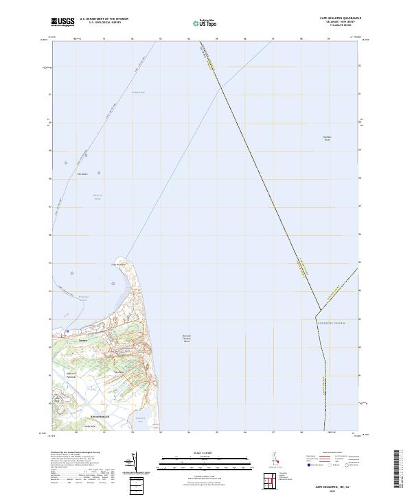
2023 Map of Cape Henlopen
USGS Topo · Published 2023About this map
Cape Henlopen forms the strategic point where the Delaware Bay meets the Atlantic Ocean, a maritime landscape defined by shifting sands and naval importance. This modern survey illustrates the contemporary recreational and transportation infrastructure of the Delmarva Peninsula, including the route of the Lewes - Cape May Ferry crossing from Lewes toward the New Jersey coast. Much of the coastline is preserved within Cape Henlopen State Park, which contains a network of trails such as the Pinelands Nature Trl and Walking Dunes Trl. Further south, the Lewes and Rehoboth Canal cuts through the lowlands near Wolfe Neck and Wolfe Glade, leading toward the residential areas of Gills Neck and the northern edge of Rehoboth Beach. Hazardous offshore features like Hen and Chickens Shoal and The Shears remain clearly marked within the Harbor of Refuge.
Find a feature on this map
41 named features on this map. Tap any name to fly to it.
Don’t see what you’re looking for? This feature index may not catch every label — zoom into the map to look around manually.
Map Details
Editions of this 2023 Cape Henlopen Map
This is the sole edition of this map. No revisions or reprints were ever made.
Other maps of this area

1888 · Cape May
USGS Topo · 1:62,500

1893 · Cape May
USGS Topo · 1:62,500

1898 · Cape May
USGS Topo · 1:62,500

1918 · Rehoboth
USGS Topo · 1:62,500

1918 · Cape Henlopen
USGS Topo · 1:62,500

1918 · Cape May
USGS Topo · 1:62,500

1925 · Cape May
USGS Topo · 1:62,500

1937 · Cape Henlopen
USGS Topo · 1:62,500

1938 · Rehoboth
USGS Topo · 1:62,500
1940 · Cape May
USGS Topo · 1:62,500