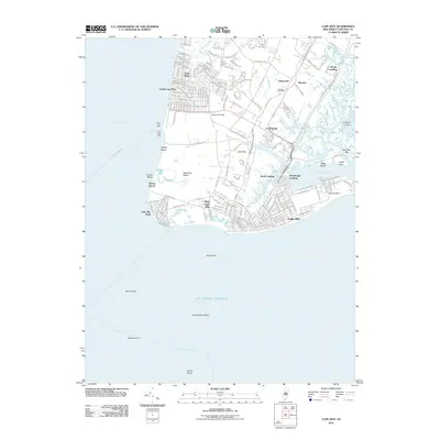
2011 Map of Cape May
USGS Topo · Published 2011About this map
Cape May and its surrounding coastal communities sit at the southern tip of New Jersey where the Delaware Bay meets the Atlantic Ocean. This early 21st-century record illustrates the dense street grids of West Cape May and Cape May Point alongside established inland hamlets like Cold Spring and Erma. The landscape is a complex network of coastal features, including the protected waters of Cape May Harbor and Jarvis Sound, and numerous landings such as Weeks Landing and Schellenger Landing.
Find a feature on this map
50 named features on this map. Tap any name to fly to it.
Don’t see what you’re looking for? This feature index may not catch every label — zoom into the map to look around manually.
Map Details
Editions of this 2011 Cape May Map
This is the sole edition of this map. No revisions or reprints were ever made.
Other maps of this area

1888 · Cape May
USGS Topo · 1:62,500

1888 · Dennisville
USGS Topo · 1:62,500

1890 · Maurice Cove
USGS Topo · 1:62,500

1891 · Maurice Cove
USGS Topo · 1:62,500

1893 · Cape May
USGS Topo · 1:62,500

1894 · Dennisville
USGS Topo · 1:62,500

1898 · Cape May
USGS Topo · 1:62,500

1899 · Vineland
USGS Topo · 1:125,000

1918 · Cape Henlopen
USGS Topo · 1:62,500

1918 · Cape May
USGS Topo · 1:62,500