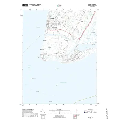
2019 Map of Cape May
USGS Topo · Published 2019About this map
Cape May Point and the surrounding coastline of Lower Township define this detailed survey of New Jersey's southernmost tip. The map captures the complex hydrology of the peninsula, where the Delaware Bay meets the Atlantic Ocean. Inland, established communities like Cold Spring and West Cape May are shown with their modern street grids and local landmarks, including Lighthouse Pond and Lake Lily. The eastern marshlands are a labyrinth of tidal water bodies such as Jarvis Sound, Reubens Thorofare, and Skunk Sound Ditch, reflecting the area's maritime character.
Find a feature on this map
60 named features on this map. Tap any name to fly to it.
Don’t see what you’re looking for? This feature index may not catch every label — zoom into the map to look around manually.
Map Details
Editions of this 2019 Cape May Map
This is the sole edition of this map. No revisions or reprints were ever made.
Other maps of this area

1888 · Cape May
USGS Topo · 1:62,500

1888 · Dennisville
USGS Topo · 1:62,500

1890 · Maurice Cove
USGS Topo · 1:62,500

1891 · Maurice Cove
USGS Topo · 1:62,500

1893 · Cape May
USGS Topo · 1:62,500

1894 · Dennisville
USGS Topo · 1:62,500

1898 · Cape May
USGS Topo · 1:62,500

1899 · Vineland
USGS Topo · 1:125,000

1918 · Cape Henlopen
USGS Topo · 1:62,500

1918 · Cape May
USGS Topo · 1:62,500