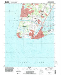
1995 Map of Cape May
USGS Topo · Published 2000About this map
The tip of the New Jersey peninsula at Cape May reveals a complex coastal landscape where the Atlantic Ocean meets Delaware Bay. This mid-1990s data shows the densely settled resorts of West Cape May and Cape May Point positioned against the protected environments of the Cape May State Park and Higbee Beach State Wildlife Management Area. Marine navigation is central to the area's identity, evidenced by the Intracoastal Waterway cutting through the land and the presence of the U S Coast Guard Lifeboat Station near the Cape May Channel.
Find a feature on this map
62 named features on this map. Tap any name to fly to it.
Don’t see what you’re looking for? This feature index may not catch every label — zoom into the map to look around manually.
Map Details
Editions of this 1995 Cape May Map
This is the sole edition of this map. No revisions or reprints were ever made.
Other maps of this area

1888 · Cape May
USGS Topo · 1:62,500

1888 · Dennisville
USGS Topo · 1:62,500

1890 · Maurice Cove
USGS Topo · 1:62,500

1891 · Maurice Cove
USGS Topo · 1:62,500

1893 · Cape May
USGS Topo · 1:62,500

1894 · Dennisville
USGS Topo · 1:62,500

1898 · Cape May
USGS Topo · 1:62,500

1899 · Vineland
USGS Topo · 1:125,000

1918 · Cape Henlopen
USGS Topo · 1:62,500

1918 · Cape May
USGS Topo · 1:62,500