
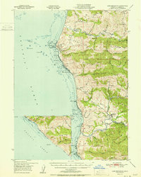
1951 Map of Cape Mendocino
USGS Topo · Published 1951About this map
Cape Mendocino stands as the westernmost point of the California coast in this mid-century survey, a landscape defined by dramatic ridges and coastal ranching life. The Coast Guard Reservation and nearby Ocean House anchor the shoreline north of Mussel Rock, while the interior reveals a network of high-elevation grazing lands such as Green Pond Ranch and Bonanza Ranch. Further south, the settlement of Petrolia sits in the valley of the Mattole River, a notable hub for the region's early petroleum history, though by this era the map notes several Oil Wells as abandoned. The terrain is marked by the Humboldt Base Line, which crosses Branstetter Ridge and Walker Ridge. Coastal navigation is highlighted by hazardous offshore features like Blunts Reef and The Great Break, providing a clear picture of the maritime risks along this stretch of Humboldt County.
Find a feature on this map
73 named features on this map. Tap any name to fly to it.
Don’t see what you’re looking for? This feature index may not catch every label — zoom into the map to look around manually.
Map Details
Editions of this 1951 Cape Mendocino Map
2 editions found
Other maps of this area

1916 · Cape Fortunas
USGS Topo · 1:62,500

1919 · Glynn
USGS Topo · 1:62,500

1920 · Pt. Delagda
USGS Topo · 1:62,500

1921 · Cape Mendocino
USGS Topo · 1:62,500

1926 · Gorda
USGS Topo · 1:62,500

1943 · Ferndale
USGS Topo · 1:62,500

1944 · Fortuna
USGS Topo · 1:62,500

1949 · Eureka
USGS Topo · 1:250,000

1949 · Point Delgada
USGS Topo · 1:62,500

1950 · Cape Mendocino
USGS Topo · 1:62,500