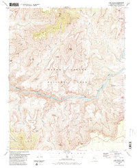
1988 Map of Cape Royal
USGS Topo · Published 1988About this map
Vishnu Temple and Wotans Throne dominate this late-twentieth-century study of the central canyon corridor, where the Colorado River carves through the Granite Gorge. The map documents a landscape defined by vertical relief and early industrial attempts, evidenced by the Last Chance Mine near Horseshoe Mesa and the Hance Mine situated within Asbestos Canyon. For researchers of early canyon exploration and mining, these labels alongside Miners Spring and various unnamed prospects indicate the proximity of mineral interests to the river’s edge.
Find a feature on this map
51 named features on this map. Tap any name to fly to it.
Don’t see what you’re looking for? This feature index may not catch every label — zoom into the map to look around manually.
Map Details
Editions of this 1988 Cape Royal Map
2 editions found
Other maps of this area

1886 · San Francisco Mtns
USGS Topo · 1:250,000

1886 · Chino
USGS Topo · 1:250,000

1886 · Echo Cliffs
USGS Topo · 1:250,000

1886 · Kaibab
USGS Topo · 1:250,000

1891 · San Francisco Mtns
USGS Topo · 1:250,000

1891 · Chino
USGS Topo · 1:250,000

1891 · Echo Cliffs
USGS Topo · 1:250,000

1894 · San Francisco Mtns
USGS Topo · 1:250,000

1899 · San Francisco Mtns
USGS Topo · 1:250,000

1903 · Bright Angel
USGS Topo · 1:48,000