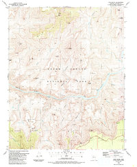
1988 Map of Cape Royal
USGS Topo · Published 1988About this map
Last Chance Mine and the Hance Mine remain as physical evidence of prospecting efforts within the inner canyon, connected to the rim by historical routes like the Hance Trail. The sheer verticality of the terrain is represented by monumental landmarks named for spiritual and classical traditions, including Vishnu Temple, Krishna Shrine, and Venus Temple. At the bottom of the Granite Gorge, the Colorado River is marked by its characteristic turbulence at Sockdolager Rapids and Nevills Rapids. Above the river, the landscape transitions from the isolated Horseshoe Mesa to the high vantage points of Cape Royal and Moran Point along the East Rim Drive. This 1980s field-checked survey documents the complex network of footpaths, such as the Tonto Trail (Foot), that navigate the intricate drainages of Asbestos Canyon and Seventyfive Mile Creek.
Find a feature on this map
53 named features on this map. Tap any name to fly to it.
Don’t see what you’re looking for? This feature index may not catch every label — zoom into the map to look around manually.
Map Details
Editions of this 1988 Cape Royal Map
2 editions found
Other maps of this area

1886 · San Francisco Mtns
USGS Topo · 1:250,000

1886 · Chino
USGS Topo · 1:250,000

1886 · Echo Cliffs
USGS Topo · 1:250,000

1886 · Kaibab
USGS Topo · 1:250,000

1891 · San Francisco Mtns
USGS Topo · 1:250,000

1891 · Chino
USGS Topo · 1:250,000

1891 · Echo Cliffs
USGS Topo · 1:250,000

1894 · San Francisco Mtns
USGS Topo · 1:250,000

1899 · San Francisco Mtns
USGS Topo · 1:250,000

1903 · Bright Angel
USGS Topo · 1:48,000