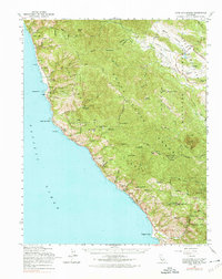
1961 Map of Cape San Martin
USGS Topo · Published 1975About this map
The Santa Lucia Range dominates this coastal landscape, where the peaks of the Los Padres National Forest meet the Pacific Ocean at the Monterey and San Luis Obispo county line. The map captures a rugged interface of inland canyons and shoreline cliffs, featuring small coastal settlements like Plaskett and Gorda along the highway. Social and administrative infrastructure is visible through the Pacific Valley Sch, the Pacific Valley Guard Station, and the Salmon Creek Ranger Sta.
Find a feature on this map
66 named features on this map. Tap any name to fly to it.
Don’t see what you’re looking for? This feature index may not catch every label — zoom into the map to look around manually.
Map Details
Editions of this 1961 Cape San Martin Map
2 editions found
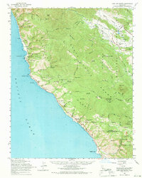
Other maps of this area

1919 · King City
USGS Topo · 1:62,500

1919 · Junipero Serra
USGS Topo · 1:62,500

1919 · Bryson
USGS Topo · 1:62,500

1919 · Piedras Blancas
USGS Topo · 1:62,500

1919 · San Simeon
USGS Topo · 1:62,500

1921 · Cape San Martin
USGS Topo · 1:62,500

1921 · Lucia
USGS Topo · 1:62,500

1927 · Piedras Blancas
USGS Topo · 1:62,500

1937 · San Simeon
USGS Topo · 1:62,500

1939 · King City
USGS Topo · 1:62,500