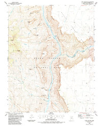
1988 Map of Cape Solitude
USGS Topo · Published 1988About this map
The Colorado River flows through the heart of the Grand Canyon National Park, where its confluence with the Little Colorado River marks a sharp transition in the canyon landscape. This 1980s-era topographic survey shows the dramatic verticality of the Desert Facade and the Palisades of the Desert, which rise steeply toward Cape Solitude and Peshlakai Point. The map details a labyrinth of geological formations, from Gunther Castle to Temple Butte, and includes the turbulent waters of Sixtymile Rapids.
Find a feature on this map
42 named features on this map. Tap any name to fly to it.
Don’t see what you’re looking for? This feature index may not catch every label — zoom into the map to look around manually.
Map Details
Editions of this 1988 Cape Solitude Map
2 editions found
Other maps of this area

1886 · Echo Cliffs
USGS Topo · 1:250,000

1891 · Echo Cliffs
USGS Topo · 1:250,000

1907 · Vishnu
USGS Topo · 1:48,000

1954 · Nankoweap
USGS Topo · 1:62,500

1954 · Shinumo Altar
USGS Topo · 1:62,500

1955 · Blue Spring
USGS Topo · 1:62,500

1956 · Marble Canyon
USGS Topo · 1:250,000

1959 · Marble Canyon
USGS Topo · 1:250,000

1961 · Marble Canyon
USGS Topo · 1:250,000
1962 · Vishnu Temple
USGS Topo · 1:62,500