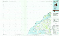
1985 Map of Cape Vincent
USGS Topo · Published 1985About this map
Lake Ontario and the St Lawrence River meet at the head of the Thousand Islands in this mid-1980s planimetric study of Jefferson County. The map details a landscape where international water boundaries divide Wellesley Island and Grindstone Island from their Canadian neighbors, and the shoreline is heavily shaped by state conservation efforts. A visible Old Railroad Grade north of Limerick and Rosiere provides a trace of former industrial transport through the region. Inland, the map documents the rural settlement patterns at crossroads like Depauville, Smith Corners, and Clayton Center, while identifying extensive protected wetlands such as the Perch River State Wildlife Management Area and Ashland Flats State Wildlife Management Area. Numerous island features, including Carleton Island and Picton Island, are charted along the river's American Narrows.
Find a feature on this map
65 named features on this map. Tap any name to fly to it.
Don’t see what you’re looking for? This feature index may not catch every label — zoom into the map to look around manually.
Map Details
Editions of this 1985 Cape Vincent Map
2 editions found
Other maps of this area

1893 · Sackets Harbor
USGS Topo · 1:62,500

1895 · Sacketts Harbor
USGS Topo · 1:62,500

1895 · Stony Island
USGS Topo · 1:62,500

1895 · Watertown
USGS Topo · 1:62,500

1895 · Cape Vincent
USGS Topo · 1:62,500

1898 · Watertown
USGS Topo · 1:62,500

1900 · Clayton
USGS Topo · 1:62,500

1903 · Grindstone
USGS Topo · 1:62,500

1903 · Clayton
USGS Topo · 1:62,500

1903 · Alexandria Bay
USGS Topo · 1:62,500