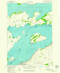
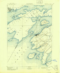
1958 Map of Cape Vincent North
USGS Topo · Published 1961About this map
The St Lawrence River serves as a wide international corridor here, marking the boundary between New York and Ontario. Along the southern shore, Cape Vincent thrives as a maritime hub, supported by a U S Coast Guard Station and a Fish Hatchery. The landscape is dominated by large river islands, including Wolfe Island and Carleton Island, which are characterized by numerous coves like Irvine Bay and Murray Bay. On the New York mainland, an Old Railroad Grade runs parallel to the river, a remnant of former transportation networks that connected the river ports to the interior. Local history is preserved in several burial grounds, such as Riverside Cem and St Vincent de Paul Cem, while Burnham Point State Park offers a public look at the shoreline just north of the village.
Find a feature on this map
60 named features on this map. Tap any name to fly to it.
Don’t see what you’re looking for? This feature index may not catch every label — zoom into the map to look around manually.
Map Details
Editions of this 1958 Cape Vincent North Map
3 editions found
Other maps of this area

1895 · Cape Vincent
USGS Topo · 1:62,500

1900 · Clayton
USGS Topo · 1:62,500

1903 · Grindstone
USGS Topo · 1:62,500

1903 · Clayton
USGS Topo · 1:62,500

1942 · Cape Vincent North
USGS Topo · 1:31,680

1942 · Chaumont
USGS Topo · 1:31,680

1942 · Sawmill Bay
USGS Topo · 1:31,680

1942 · Cape Vincent South
USGS Topo · 1:31,680
1943 · Grindstone
USGS Topo · 1:31,680
1944 · Cape Vincent
USGS Topo · 1:62,500