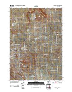
2011 Map of Capehart Lake
USGS Topo · Published 2011About this map
Capehart Lake and the surrounding high desert terrain define this corner of Harney County, characterized by ephemeral water bodies and prominent landforms. The landscape is marked by the elevated Juniper Ridge to the north and the distinct Coyote Rim toward the east. This 2011 survey documents a sparsely populated area where the primary human footprint is found in the path of Squaw Butte Rd as it cuts diagonally across the western section of the map. Smaller features like Blowhole Lake highlight the unique hydrography of the region, where water sources are vital landmarks for those navigating or managing this remote stretch of the Oregon interior.
Find a feature on this map
5 named features on this map. Tap any name to fly to it.
Don’t see what you’re looking for? This feature index may not catch every label — zoom into the map to look around manually.
Map Details
Editions of this 2011 Capehart Lake Map
This is the sole edition of this map. No revisions or reprints were ever made.
Other maps of this area

1955 · Burns
USGS Topo · 1:250,000

1958 · Burns
USGS Topo · 1:250,000

1959 · Burns
USGS Topo · 1:250,000

1979 · Moon Reservoir
USGS Topo · 1:24,000

1980 · Capehart Lake
USGS Topo · 1:24,000

1980 · Squaw Butte
USGS Topo · 1:24,000

1980 · Iron Mtn. Flat
USGS Topo · 1:24,000

1980 · Alec Butte
USGS Topo · 1:24,000

1980 · Lake on The Trail
USGS Topo · 1:24,000
1981 · Oakerman Lakes
USGS Topo · 1:24,000