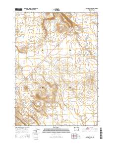
2014 Map of Capehart Lake
USGS Topo · Published 2014About this map
Capehart Lake and the Yellowstone Waterhole punctuate the high-desert landscape of Harney County, illustrating the vital role of water resources in this arid cattle-country region. In 2014, the area remains defined by the Public Land Survey System, showing the corner boundaries of t24s r26e, t24s r27e, t25s r26e, and t25s r27e. The primary artery through the terrain is Us-395, which cuts diagonally across the quadrangle, serving as the main transportation corridor through the basin. Local access is represented by routes like Placidea Butte Rd, providing a look at the sparse but essential road network used by ranchers and land managers in the vast interior of Eastern Oregon.
Find a feature on this map
9 named features on this map. Tap any name to fly to it.
Don’t see what you’re looking for? This feature index may not catch every label — zoom into the map to look around manually.
Map Details
Editions of this 2014 Capehart Lake Map
This is the sole edition of this map. No revisions or reprints were ever made.
Other maps of this area

1955 · Burns
USGS Topo · 1:250,000

1958 · Burns
USGS Topo · 1:250,000

1959 · Burns
USGS Topo · 1:250,000

1979 · Moon Reservoir
USGS Topo · 1:24,000

1980 · Capehart Lake
USGS Topo · 1:24,000

1980 · Squaw Butte
USGS Topo · 1:24,000

1980 · Iron Mtn. Flat
USGS Topo · 1:24,000

1980 · Alec Butte
USGS Topo · 1:24,000

1980 · Lake on The Trail
USGS Topo · 1:24,000
1981 · Oakerman Lakes
USGS Topo · 1:24,000