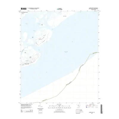
2014 Map of Capers Inlet
USGS Topo · Published 2014About this map
Capers Island and Dewees Island anchor this coastal survey, illustrating the complex geography of the South Carolina lowcountry. The land is defined by a series of barrier islands and marshy sounds, including Copahee Sound and Bullyard Sound, which separate the mainland from the Atlantic. The Intracoastal Waterway threads through these tidal environments, passing Mary Island as it provides a navigable corridor protected from the open ocean.
Find a feature on this map
29 named features on this map. Tap any name to fly to it.
Don’t see what you’re looking for? This feature index may not catch every label — zoom into the map to look around manually.
Map Details
Editions of this 2014 Capers Inlet Map
This is the sole edition of this map. No revisions or reprints were ever made.
Other maps of this area

1919 · The Jetties
USGS Topo · 1:21,120

1919 · Capers Island
USGS Topo · 1:21,120

1919 · Wando
USGS Topo · 1:21,120

1919 · Fort Moultrie
USGS Topo · 1:21,120

1919 · Bulls Island
USGS Topo · 1:21,120

1919 · Sewee Bay
USGS Topo · 1:21,120

1943 · Capers Island
USGS Topo · 1:24,000

1943 · Fort Moultrie
USGS Topo · 1:24,000

1943 · Wando
USGS Topo · 1:24,000

1943 · Sewee Bay
USGS Topo · 1:24,000