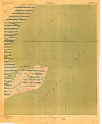
1919 Map of Bulls Island
USGS Topo · Published 1919About this map
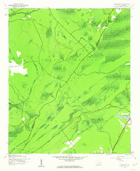
Bulls Island dominates this 1918 survey, offering a look at the intricate coastal geography of South Carolina before modern development. At this time, the island’s interior was navigated via a simple network of thoroughfares, including Old Fort Road, Lighthouse Road, and Avenue Road. These paths connected key landmarks like the Old Fort and the now-defunct Bulls Bay L H (Abandoned) lighthouse on the northeastern point.
Find a feature on this map
18 named features on this map. Tap any name to fly to it.
Don’t see what you’re looking for? This feature index may not catch every label — zoom into the map to look around manually.
Map Details
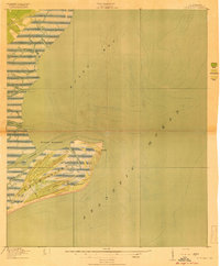
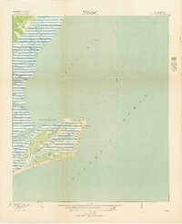
Editions of this 1919 Bulls Island Map
3 editions found
Other maps of this area

1919 · Capers Island
USGS Topo · 1:21,120

1919 · Sewee Bay
USGS Topo · 1:21,120
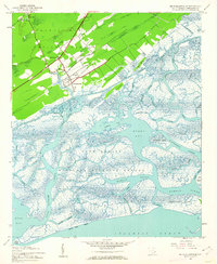
1942 · Mc Clellanville
USGS Topo · 1:24,000

1943 · Capers Island
USGS Topo · 1:24,000

1943 · Sewee Bay
USGS Topo · 1:24,000

1943 · Bulls Island
USGS Topo · 1:24,000

1943 · Awendaw
USGS Topo · 1:24,000
1943 · Ocean Bay
USGS Topo · 1:24,000

1948 · James Island
USGS Topo · 1:250,000

1949 · Georgetown
USGS Topo · 1:250,000