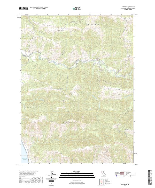
2021 Map of Capetown
USGS Topo · Published 2021About this map
Capetown anchors this coastal landscape where the Bear River meets the Pacific Ocean in Humboldt County. The map details a series of dramatic ridges and drainages, including Bear River Ridge and Southmayd Ridge, which define the ranching and timber geography of the region. Notable landmarks such as Smith Rock and Red Rock stand out along the river valley, while higher elevations like Bunker Hill and Twin Peaks overlook the terrain. The presence of Indian Prairie suggests specific land-use patterns or natural openings in the coastal forest. The transportation network is dominated by rural corridors like Mattole Rd and various ranch access routes such as Fruit Ranch Rd and Walch Ranch Rd, illustrating the continued importance of livestock and resource management in this part of Northern California.
Find a feature on this map
41 named features on this map. Tap any name to fly to it.
Don’t see what you’re looking for? This feature index may not catch every label — zoom into the map to look around manually.
Map Details
Editions of this 2021 Capetown Map
This is the sole edition of this map. No revisions or reprints were ever made.
Other maps of this area

1916 · Cape Fortunas
USGS Topo · 1:62,500

1919 · Glynn
USGS Topo · 1:62,500

1921 · Cape Mendocino
USGS Topo · 1:62,500

1943 · Ferndale
USGS Topo · 1:62,500

1944 · Fortuna
USGS Topo · 1:62,500

1949 · Eureka
USGS Topo · 1:250,000

1950 · Cape Mendocino
USGS Topo · 1:62,500

1950 · Scotia
USGS Topo · 1:62,500

1951 · Scotia
USGS Topo · 1:62,500

1951 · Cape Mendocino
USGS Topo · 1:62,500