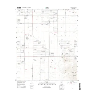
2013 Map of Capitol Dome
USGS Topo · Published 2013About this map
Deming anchors the northwestern corner of this landscape, where residential streets like Pear St SE and Atlantic Way SE give way to a structured grid of rural roads and desert terrain. The southern portion of the sheet is dominated by the northern reaches of the Florida Mountains, a topographic complex featuring prominent landmarks such as Capitol Dome, Dragon Ridge, and Chimney Point. These peaks rise sharply above the Capitol Dome Draw and Mexican Canyon, creating a stark transition from the level basin floor to the high desert heights. This 2013 survey illustrates the modern intersection of suburban expansion and the high-desert environment, where family-named landmarks like Navajo Bill Hill sit adjacent to contemporary developments. The road network, including the evocative Whiskey Springs Rd and Stagecoach Trl SE, suggests the historical routes that once traversed this part of Luna County, now formalized into a residential and agricultural grid.
Find a feature on this map
120 named features on this map. Tap any name to fly to it.
Don’t see what you’re looking for? This feature index may not catch every label — zoom into the map to look around manually.
Map Details
Editions of this 2013 Capitol Dome Map
This is the sole edition of this map. No revisions or reprints were ever made.
Other maps of this area

1899 · Deming
USGS Topo · 1:125,000

1915 · Deming
USGS Topo · 1:125,000

1955 · Las Cruces
USGS Topo · 1:250,000

1958 · Las Cruces
USGS Topo · 1:250,000

1964 · Gym Peak
USGS Topo · 1:24,000

1964 · Deming West
USGS Topo · 1:24,000

1964 · Florida Gap
USGS Topo · 1:24,000

1965 · South Peak
USGS Topo · 1:24,000

1965 · Deming East
USGS Topo · 1:24,000
1965 · Midway Butte
USGS Topo · 1:24,000