
1964 Map of Florida Gap
USGS Topo · Published 1967About this map
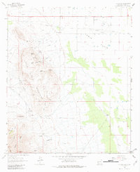
Little Florida Mountains dominate the western half of this mid-1960s survey, showing a landscape defined by volcanic geology and mining activity. The map records several mineral operations, including the West Mine, Stud Mine, and Bradley Mines, alongside scattered prospects and Tailings Ponds. The presence of Rock Hound State Park highlights the area's geological draw, while the Indian Post Office and Little Needles Eye mark distinctive high-altitude landmarks. To the east, the terrain levels out into the Lewis Flats, where a community cluster emerges around the Lewis Flats Sch, Lewis Flats Ch, and Lewis Cem. This transition from the craggy heights of Agate Point to the ranching and settlement patterns at Kit Ranch and Headquarters illustrates the dual economy of mineral extraction and desert habitation in southern New Mexico.
Find a feature on this map
40 named features on this map. Tap any name to fly to it.
Don’t see what you’re looking for? This feature index may not catch every label — zoom into the map to look around manually.
Map Details
Editions of this 1964 Florida Gap Map
2 editions found
Other maps of this area

1899 · Deming
USGS Topo · 1:125,000

1915 · Deming
USGS Topo · 1:125,000

1955 · Las Cruces
USGS Topo · 1:250,000

1958 · Las Cruces
USGS Topo · 1:250,000

1964 · Gym Peak
USGS Topo · 1:24,000

1965 · South Peak
USGS Topo · 1:24,000

1965 · Deming East
USGS Topo · 1:24,000

1965 · Carne
USGS Topo · 1:24,000
1965 · Capitol Dome
USGS Topo · 1:24,000

1972 · Myndus
USGS Topo · 1:24,000