
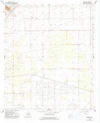
1965 Map of Carne
USGS Topo · Published 1967About this map
Atchison Topeka and Santa Fe and Southern Pacific rail lines dominate this high desert landscape of Luna County, converging near the small settlement of Carne. The terrain transitions from the rugged slopes of the Cooks Range in the northwest to the wide, open expanse of the Lewis Flats in the south. This 1960s survey illustrates a specialized ranching and infrastructure economy dependent on groundwater, evidenced by a network of named water sources like Peach Orchard Windmill, Kelly Windmill, Wolf Windmill, and Eagles Windmill. A notable Radio Facility and a Sandpit indicate mid-century industrial and communications activity in this arid region. The presence of a winding Jeep Trail and various wells further underscores the remote, utilitarian nature of the territory during this era of New Mexican history.
Find a feature on this map
14 named features on this map. Tap any name to fly to it.
Don’t see what you’re looking for? This feature index may not catch every label — zoom into the map to look around manually.
Map Details
Editions of this 1965 Carne Map
2 editions found
Other maps of this area

1899 · Deming
USGS Topo · 1:125,000

1915 · Deming
USGS Topo · 1:125,000

1955 · Las Cruces
USGS Topo · 1:250,000

1958 · Las Cruces
USGS Topo · 1:250,000

1964 · Florida
USGS Topo · 1:24,000

1964 · Massacre Peak
USGS Topo · 1:24,000

1964 · Florida Gap
USGS Topo · 1:24,000

1965 · Deming East
USGS Topo · 1:24,000
1965 · Capitol Dome
USGS Topo · 1:24,000

1972 · Myndus
USGS Topo · 1:24,000